


2 days workshop on the theme-Geo Database Vetting and Attribute Data Collection on Formulation of GIS Based Master Plans for Kargil City Under Amrut Mission begins in Kargil
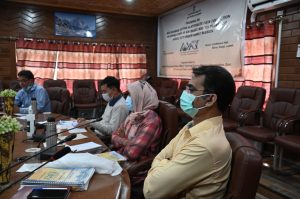
KARGIL, SEPTEMBER 02, 2021: 2 days workshop cum training programme on the theme-Geo Database Vetting and Attribute Data Collection on Formulation of GIS Based Master Plans for Kargil City Under AMRUT Mission jointly organized by the Ministry of Housing and Urban Affairs/ Town and Country Planning Organization, Government of India and Urban Local Bodies Ladakh started at Conference Hall Baroo here on Wednesday.
During the training programme, participants are being imparted training in vetting and data collection on draft base map of Kargil Town provided by National Remote Sensing Centre under Sub Scheme of Formulation of Geographical Information System (GIS) based master plan for Kargil town.
Director Urban Local Bodies Ladakh Dr Zahida Banoo, Vice President Municipal Committee Kargil Gulzar Hussain, Town and Country Planner, Planning Organization Ministry of Housing and Urban Affairs Government of India Monis Khan, Executive Officer MC Kargil
Shafaqat Ali Khan, Executive Engineer PHE Division Subhash Chandra, Executive Engineer KDA Sajjad Hussain Wazir, Consultant Pashim Tiwari, Technical Director All India Institute of Local Self Government besides officers and officials from MC, KDA, PHE were also present during the training session.
Delivering his introductory remarks, Town and Country Planner Monis Khan said that Government of India has launched Atal Mission For Rejuvenation and Urban Transformation (AMRUT) scheme in November 2015 for the implementation of various schemes under which Preparation of Geographical Information System (GIS) Based Mater Plan for 500 cities is one of the most important reform, adding he said that the Ministry of Housing and Urban Affairs (MoHUA) has approved this reform as a Sub Scheme and the State Mission Directorate is the implementing agency.
While highlighting the objective of such training camps he said that it aims to develop common digital geo-referenced base maps and land use maps at 1:4000 scale on (GIS) Platform using very high resolution satellite data and to formulate master plan for 500 cities selected as AMRUT cities under which Kargil District is also included.
Later, Monis Khan gave a detailed powerpoint presentation and informed the participants about the various necessary skills required for mapping, survey and data collection.
An interactive question answer session was also held on the occasion.